From “Striking Eight Bells: A Vietnam Memoir.”
“Another story on what most Americans don’t know about the Navy’s role in the Vietnam War.”
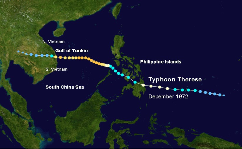
Many Americans probably believed that by 1972, the war in Vietnam was essentially winding down. However, for the U.S. Navy in Vietnam, 1972 would prove to be a busy year of conducting numerous and dangerous combat operations. On November 30, Typhoon Therese developed east of the Philippines. Therese struck the Philippines on December 3. After crossing the Philippine islands, Therese reached peak winds of 120 mph winds while in the South China Sea, which was very rare for the month of December, late in the tropical storm season. The typhoon’s intensity fluctuated, but it continued westward and arrived off the coast of South Vietnam on December 9, as a typhoon with wind gusts of up to 115 mph.
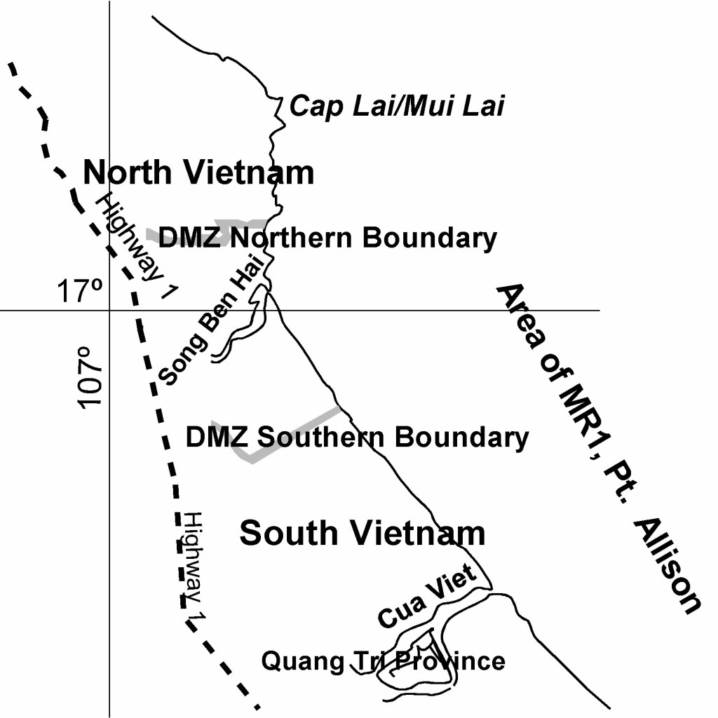
Just the week before our ship USS Rich (DD 820) had been assigned to Commander Task Unit (CTU) 71.1.1, where along with USS Henry B. Wilson (DDG 7) and the destroyer USS Rowan (DD 782), our Task Unit had spent five days conducting strike missions and raids up and down the North Vietnam coast from Dong Hoi Gulf north to Vinh Son and Brandon Bay. On December 6, our ship was released from CTU 71.1.1, and we had orders to report to CTG 75.9. It would be back to the gun line in MR1 for us. The assigned Naval Gunfire Support Station for our ship was back to Point Allison, near the DMZ.
The ship went to Watch Condition II. For watch standing, that shifted everyone back into the six-hours on and six-hours off watch rotations. Over the radio, we reported in with the naval gunfire liaison officer (NGLO) and Marine spotter shortly after noon. By 1330 we received the spotter’s radio call for our first gunfire support mission. It was right back in the naval gunfire support (NGFS) saddle for us. By the end of the watch, our ship had fired 363 HE rounds on various targets designated by the Marine spotter. The days were once again filled with firing our 5-inch/38 caliber guns on spotted targets at MR1, often detaching at night to proceed out to “Yankee Station,” to conduct underway replenishment to refuel and rearm the ship, then back to MR1.

Starting on December 10, in addition to the bad weather courtesy of Typhoon Therese, the ship’s evaporator equipment was struggling. The ship had two evaporator plants for making freshwater and boiler feed water. One plant was located in B-2, the main engine room/main control, and the other plant was in the B-4 after engine room. The B-2 plant had been down for over a day with engineers unable to repair it due to not having the required parts on board.
That left the single evaporator plant in B-4 to make all of the necessary freshwater and boiler feed water for the ship. To conserve freshwater, the ship went to even stricter water hours; even the “scuttlebutts” (drinking fountains) were secured. Nearly all of the freshwater made by the single evaporator plant was diverted as boiler feed water for use in the propulsion boilers.
The next night, on December 11, the gunfire support missions undertaken by the ship during the mid-watch would turn out to be our last, at least for a while. The single operating evaporator plant in B-4 engine room could not keep up with the demands of making enough boiler feed water. At 0400 that morning, our ship was detached from CTG 75.9 and ordered to proceed out to Yankee Station and report to CTG 77.6 embarked on USS America (CVA 66). The ship spent the day operating as plane guard for America during the carrier’s flight operations while our engineers kept trying to repair the evaporator plant in main control and keep the struggling plant in B-4 making water.
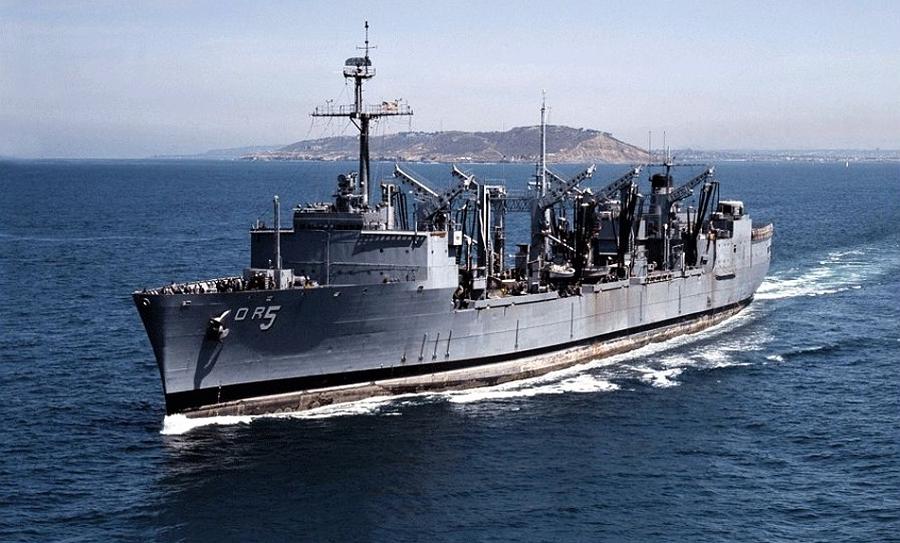
At 0239 on December 12, our ship went alongside USS Wabash (AOR 5) for our FAS replenishment. Precise steering by both ships is vital during alongside underway replenishment. Before beginning our approach to Wabash, she changed the replenishment course to 300 degrees (northwest-by-west). Our ship would come alongside Wabash’s starboard side and we would be port-side-to Wabash for the replenishment. The idea was to put the weather on our starboard quarters, which could make for a better ride and steering. It was a tough refueling operation all around for those on the bridge and on deck because of the typhoon force winds and high sea wave conditions. Both our ship and Wabash were experiencing rolling and pitching while alongside. Obviously, being a destroyer, our ship’s rolling and pitching was much more severe than Wabash’s.
In heavy sea state conditions, steering exact gyro compass courses and not being more than one degree off the ordered course at any time can be extremely challenging for any helmsman. For me, it was a big test. This was another new experience of fighting the weather helm to stay on a precise course for over three consecutive hours. A momentary loss of mental alertness or awareness could cause you to allow the ship to get well off the intended course. The last thing any helmsman ever wants to hear from the conning officer is the command “Mind your helm,” which means “Wake the hell up; your steering sucks.”
Finally, at 0437, the refueling was complete and all lines were clear. Ten minutes later, after breakaway, our ship was clear of Wabash and secured from the underway replenishment detail.
On December 13, shortly after midnight, our ship went back alongside USS Wabash on her starboard side. I was the assigned helmsman for this underway replenishment. This underway replenishment was not for fuel, but for Wabash to pump badly needed boiler feed water over to our ship via transfer hose lines. The wind and sea state conditions had deteriorated even further from the morning before.

USS Rich (DD 820) coming alongside Wabash (AOR 5) out at Yankee Station in the Tonkin Gulf. December 1972.**
The replenishment course was 070 degrees (east-north-east), speed 10 knots. Once alongside, I was finding it extremely difficult to keep our ship on the replenishment course. Apparently, the helmsman on Wabash was having similar difficulties. The two ships were about 80 to 90 feet apart and both were rolling, pitching, and yawing so severely that it was considered unsafe to continue. About 25 minutes into the transfer, the captain on Wabash made the decision to terminate the transfer and ordered an emergency breakaway of the transfer rig. Once the rig was broken and the transfer hose was clear of our ship, we began to maneuver away from Wabash. With no other immediate orders from the task group commander, our ship started the trip back to the gun line and MR1.
Sometime later that night, it was decided by the task group commander that our ship should go to Da Nang, South Vietnam, in order to repair our evaporators while at the dock. At 0635, our ship began the approach to Vinh Da Nang. To reach the actual port of Da Nang, the large open bay of Vinh Da Nang had to be transited. On the approach, one first saw Hon Son Cha Island, which had cliffs that rose to elevations of 750 feet and were separated by three-tenths of a mile from the northwest entrance point of Vinh Da Nang. The effects of Typhoon Therese were still present, with high winds and significant waves in the bay.
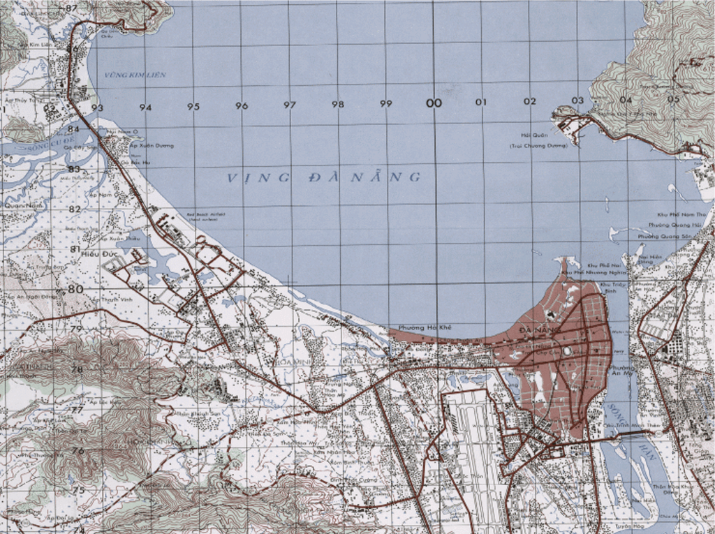 Vinh Da Nang and Da Nang, South Vietnam
The port lay on the southeast side of Vinh Da Nang on the west bank of Song Han River, close within the river mouth. Initially we tried to dock the ship in the port, but the high winds made it impossible without tug assistance. Da Nang Harbor Control directed our ship to go instead to an emergency anchorage just inside the entrance to Vinh Da Nang. We backed the ship clear of the pier area, turned around, and proceeded out to the Vinh Da Nang anchorage area.
Once we arrived at the anchorage area, we let go of the port anchor. At 0756, we set the anchor in about nine fathoms (54 feet) of water. The bottom composition at the anchorage was mud, which does not provide the best holding ground. Within moments after setting the anchor, the ship began to roll severely. The winds were still gusting to 70 knots or more. The XO and I were both on the starboard bridge wing, and as the ship rolled heavily to starboard we both had to hang onto anything we could find to stay on our feet. Looking over the bridge wing as the ship rolled, I thought the bridge wing was going to actually enter the water.
The helmsman reported from the clinometer that the roll angle had reached over 50 degrees. The first class quartermaster on the navigation plot quickly determined that the ship was dragging anchor. We let out more anchor chain, increasing the scope to increase the holding power of the anchor. Next, we took a measure rarely exercised by a ship at anchorage: we put turns on both port and starboard engines, slowly turning the propellers thrusting ahead, and kept the helmsman on the helm using the rudders to keep the bow of the ship headed into the winds and the seas while at anchorage.
By the afternoon, the weather conditions at our anchorage area had not improved. The bridge team had fought all morning, constantly maneuvering the ship while anchored to keep the ship in safe water. At 1355 we weighed anchor and moved the ship further into Vinh Da Nang to an anchorage area closer to the port of Da Nang and in better protected waters. Twenty minutes later, we anchored the ship again at Anchorage #4 in about five fathoms (30 feet) of water; the bottom composition at this anchorage was also mud.
Finally, the Da Nang Harbor Pilot boarded our ship at 1508. The pilot felt the winds had decreased enough to allow our ship to safely dock. Once again, we weighed anchor and got underway. The harbor pilot gave the maneuvering orders as we entered Da Nang harbor and docked at pier Delta, Delta Two at 1536. As a precaution, all mooring lines were doubled up and extra mooring wire ropes were put over to the dock at the bow and the stern.
The intent and purpose for our ship docking in Da Nang was to bring on board several Navy technical experts to help our engineers in repairing the evaporators. Being at the dock also gave the ship an opportunity to take on more freshwater. The scheduled time in Da Nang was initially indefinite, until the evaporators were fixed. That indefinite schedule got blown away when the local commander warned that the threat level was very high for our ship to be attacked by mortar fire while at the dock. They believed the mortar attacks would begin shortly after sunset. This information was relayed to the task group commander by the captain.
Within a short period of time, we received orders for the ship to leave the dock before sunset and to proceed back to Subic Bay. The Navy technical experts were to stay on board and continue efforts to fix the ship’s evaporators while en route to Subic Bay. The ship got underway at 1832 from Da Nang harbor and transited through Vinh Da Nang back out into the waters of the Gulf of Tonkin bound for Subic Bay. Goodbye, Vietnam, at least for now…To read “Striking Eight Bells,” use one of these links to booksellers: Amazon.com: Books, Barnes and Noble Booksellers, BAM –Books A Million and Smashword.com eBooks.

The stories in these posts and the book; “Striking Eight Bells: A Vietnam Memoir,” reflect the author’s recollection of events. Some names, locations, and identifying characteristics have been changed to protect the privacy of those depicted. Dialogue has been recreated from memory. Dates, times, and locations were recreated from declassified U.S. Navy records and others. Photographs used are either public domain or owned by the author. Illustrations and maps used were either created by the author or in the public domain. The stories in these posts and the book are solely the opinion of the author and not the publisher, Richter Publishing, LLC.
*Image was found in public domain or it could not be established after reasonable search, that any claim existed to the image. Image used for illustrative purposes only and is not the property of the author. Where ever possible credit for the image is indicated in the caption. ** Image found on social media sites posted by Stu Liggan, image can also be found on various other online sources without claimed copyright in what could be considered to be public domain.
